
Official websites use .gov
A .gov
website belongs to an official government organization in the
United States.
Secure .gov websites use HTTPS
A lock
(
) or https:// means you've safely
connected to the .gov website. Share sensitive information only
on official, secure websites.


Current Road Conditions
June 27, 2024 Update: Snow is melting, and roads may be slick and muddy. Road conditions on the forest are dynamic, especially given the post-fire hazards and storm damage. Downed trees are possible on any roads within the forest, regardless of the time of year, but especially during and after storms and wind events. Lingering snow and ice on shady, north-facing aspects and in higher elevations may continue to block roadways. View the Snow Depth Map for estimated snow levels. Remember, even with good snow tires and 4wd, less than a foot of snow is enough to get a vehicle stuck. Please note, this is not a comprehensive list, and many serious road issues may not be reported here.
Do not drive around barriers, locked gates or "Closed Road" signs. This can further undermine the stability of waterlogged ground, causing additional, long-term damage. Roads may be closed to prevent additional damage and further road repairs.
-
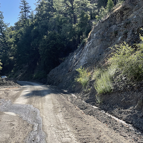
The M10 Road to Letts Lake had a slide over the winter that has been temporarily repaired, USDA Forest Service photo by Zachary Young.
Please be aware nearly 90% of the Mendocino National Forest has burned within the last four years. A burned landscape presents a number of safety hazards that either did not exist prior to the fire or have been exacerbated by the effects of the fire. In some cases, these hazardous conditions persist for several years after a fire. Landslides, hazard trees, rockfall and other debris may block roads at any time. Management activities, such as hazard tree work, burning, road repairs may also impact road accessibility or conditions. Be very aware of your surroundings, follow warning signs, area closures and directions from agency personnel, and pay particular attention to these potential safety hazards.
Before traveling to the forest, leave your trip information with a relative or friend regarding where you are going and when you are planning to return. Please drive with caution in the forest.
Road Updates
Several roads in the forest are maintained by county road departments. Please visit county websites for more information.
- Glenn County Road Conditions
- Colusa County Road Closures & Conditions
- Tehama County Road Closures
- Lake County Public Works
- Mendocino County Road Closures
Blands Cove Road:
- Open for 16 miles with access to Leech Lake Trailhead.
CR 301 (Elk Mountain Rd. maintained by Lake County):
- From Upper Lake: Road is passable with high clearance vehicle. There is a slide area that narrows to one lane. Please drive with caution.
- From the Potter Valley side: Four-wheel drive/chains advised in winter.
FH7 (County road maintained by Mendocino and Glenn Counties):
- Passable
M1:
- M1 road south from Covelo to Lake Pillsbury: Road is open for 23 miles to the M-61 turnoff. M-61 to Lake Pillsbury is open but high clearance vehicles recommended.
- M1 road north in Covelo Ranger District: At Bar Creek 3 miles north of Eel River Station, the road was temporarily repaired last year but the area is still sliding so access could be limited (high clearance vehicles recommended). Passable to Indian Dick Station with accessibility to Foster Glade Trailhead, Georges Valley Trailhead, Rock Cabin Trailhead, and Soldier Ridge Trailhead.
M2: Closed from Green Springs to Cold Springs due to downed trees.
M3: From the east side: slides and downed trees on CR 308 blocking access. From the west side: conditions unknown.
M4: Passable
M5: Closed at the 17N02 Junction to Cedar Camp.
M6: Downed trees and several slides reported but not yet repaired.
M8: Conditions unknown. Damage on road surface.
M9: Conditions unknown.
M10:
- From the east: The slide above Fouts Springs has been temporarily repaired and is passable.
- From the west: Rice Fork is passable in a high clearance 4WD vehicle. Some narrow spots and slides, but Bear Creek is accessible.
M21: Passable
M22: From the M-2 to Ides Cove trailheads is passable. Conditions of the M22 heading east to Colyer Springs Road unknown.
M61: Passable