
Official websites use .gov
A .gov
website belongs to an official government organization in the
United States.
Secure .gov websites use HTTPS
A lock
(
) or https:// means you've safely
connected to the .gov website. Share sensitive information only
on official, secure websites.


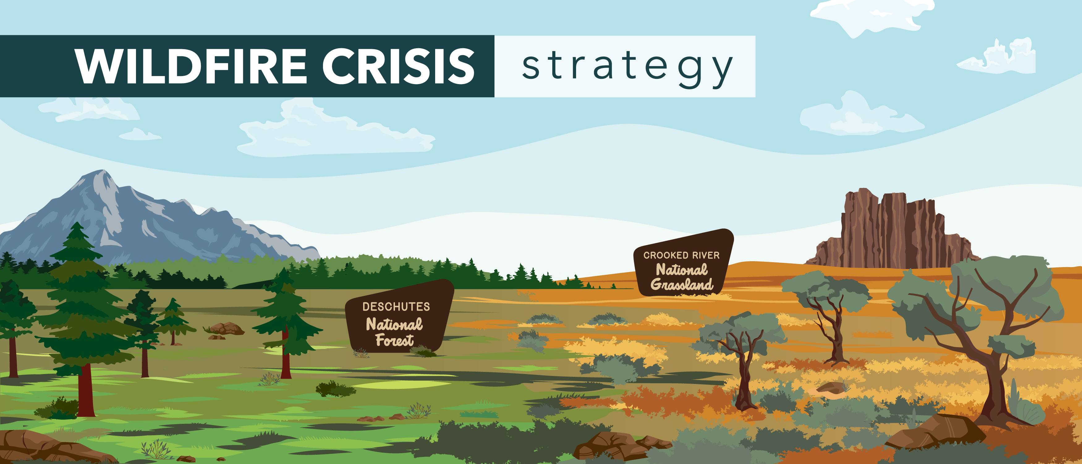
Wildfire Crisis Strategy: Central Oregon Landscape
The Forest Service has launched a robust, 10-year strategy to address western wildfires in the places where they pose the most immediate threats to communities. Central Oregon was chosen as one of the initial focal landscapes identified for targeted investments in the “Wildfire Crisis Strategy.” The strategy combines a historic investment of congressional funding with years of scientific research and planning into a national effort that will dramatically increase the scale of forest health treatments over the next decade.
Central Oregon will receive up to $43.1 million in Bipartisan Infrastructure Law (BIL) funding to implement the Wildfire Crisis Strategy through 2 024. With that investment, the Deschutes National Forest and Crooked River National Grassland along with Tribal, State and local partners, expect to treat more than 50,000 acres by 2024.
Landscape Highlights
The Central Oregon Landscape covers State, private, and Federal lands on the eastside of the Cascades. This area is rich in collaboration and has been a leader in implementing the Collaborative Forest Landscape Restoration program, Joint Chief’s Projects, and National Cohesive Strategy. Additional investments will continue to reduce the risk of fire transfer to numerous, growing communities and critical infrastructure and build upon work already accomplished.
Central Oregon is experiencing the most extensive community growth in the State with some communities increasing almost 30 percent in the past 10 years. Hundreds of thousands of acres of Federal land are immediately adjacent to communities and subdivisions, which puts those communities and subdivisions at risk of fire.
Central Oregon’s economy is driven by recreation and tourism. The Deschutes National Forest is the primary destination, setting, and background for this economy. In 2021, in trail trips alone, $136 million were spent in Deschutes County. Mitigating wildland fire risks is critical to ensuring a sustainable local economy.
Central Oregon has a long history of collaborative engagement to address wildland fires and active management to minimize impacts to communities. Further investment will allow these community-based partners to build upon work already accomplished.
Expected Outcomes
Implementation of landscape scale cross-boundary projects through cohesive partnerships will conserve and restore forested landscapes while reducing wildfire risk and impact to life, property, and economic assets in and adjacent to the communities of Bend (R6 Tier 1 Wildfire Risk), Sisters (#1 at risk Oregon Fireshed), Sunriver (#6 at risk Oregon Fireshed), LaPine, and Crescent.
Emphasizing forest health and reintroduction of fire on a larger scale complements restoration efforts to improve aquatic and terrestrial habitats for sensitive and listed species like Oregon spotted frog and Chinook salmon. The Deschutes National Forest is a leading member of a strong partner network that is strategically increasing holistic watershed function across public and private ownerships, supporting a reliable rural and urban water supply to the Bend Municipal Watershed amidst an exceptional drought.
The First Two Years: 2022 & 2023
During the first two years of work on the Central Oregon Landscape, the Deschutes National Forest and Crooked River National Grassland have focused on securing partnerships to assist in implementation, and hiring more firefighters, environmental planners, wildlife biologists, archaeologists and other personnel needed to plan and implement future projects. Adding this additional capacity is possible through funding support provided by the Wildfire Crisis Strategy via the Bipartisan Infrastructure Law (enacted by Congress in Fiscal Year 2022) and the Inflation Reduction Law (enacted by Congress in Fiscal year 2023).
-
Central Oregon Landscape Overview

Learn more about how the Deschutes National Forest & Crooked River National Grassland are addressing the wildfire crisis and some of our early success stories.
-
2023 Deschutes National Forest Spring Prescribed Burn Summary
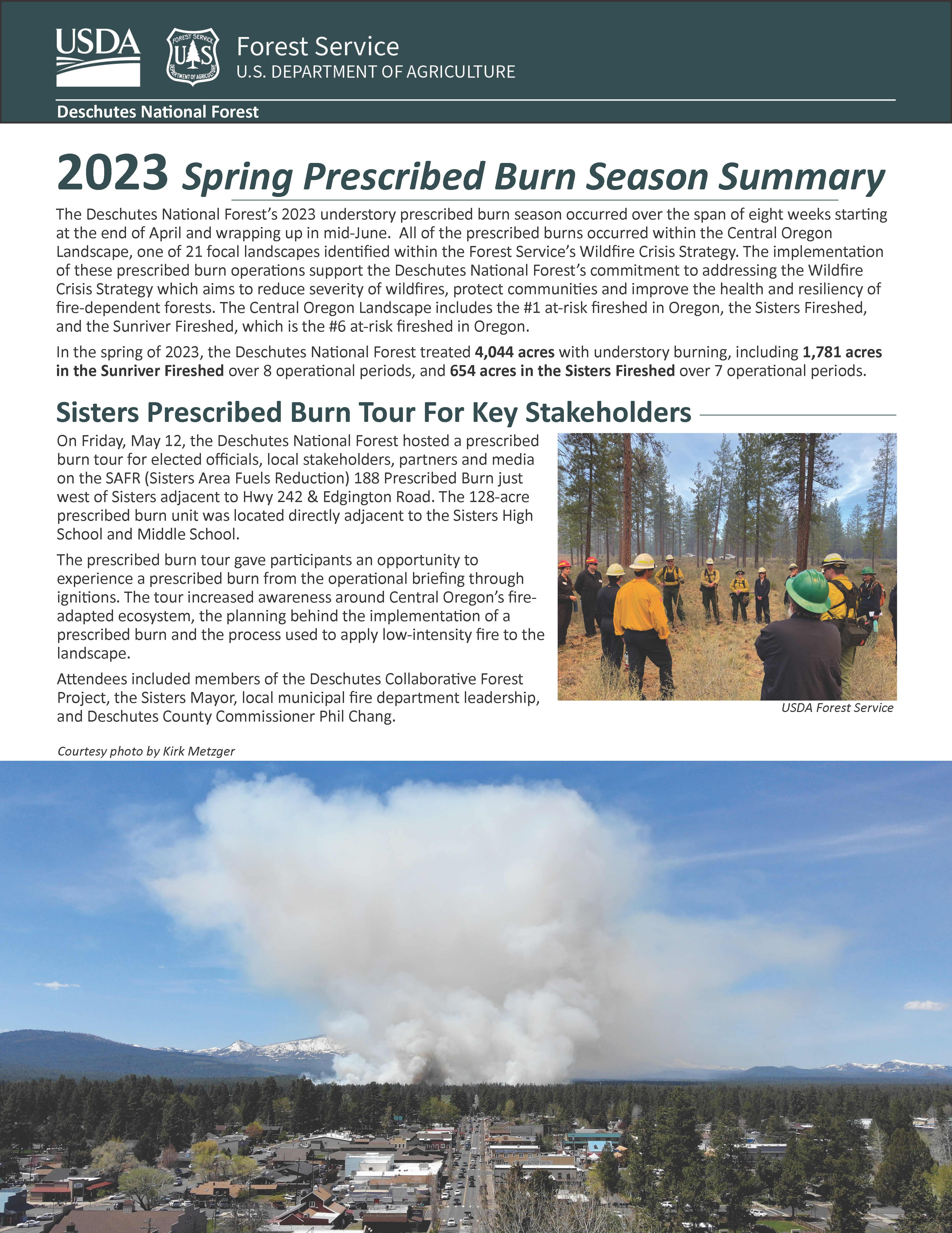
In the spring of 2023, the Deschutes National Forest treated 4,044 acres with understory burning, including 1,781 acres in the Sunriver Fireshed over 8 operational periods, and 654 acres in the Sisters Fireshed over 7 operational periods.
-
2023 "A Historic Year: Expanding the Pace & Scale of Wildfire Risk Reduction and Forest Health Treatments"
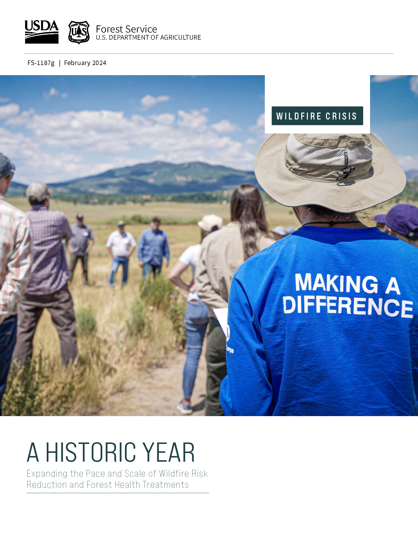
A national look at 2023's work around reducing wildfire risk and improving forest health on focal landscapes including the Central Oregon Landscape.
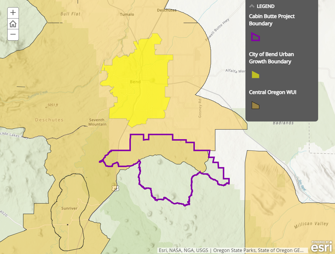
Cabin Butte Vegetation Management Project
The 25,804-acre Cabin Butte Vegetation Management project area is located just south of Bend, Oregon on the Bend-Fort Rock Ranger District of the Deschutes National Forest. The project area is less than one mile south of the Bend urban growth boundary, adjacent to private lands and approximately 11,591 acres are within the wildland urban interface as defined by the Greater Bend Community Wildfire Protection Plan.
All of the forested stands within the project area were previously harvested and clear-cut in the early 1900’s when the land was owned by Brooks-Scanlon logging companies. The land came under federal ownership in the 1930’s and has since regenerated with Ponderosa pine.
Historically, these dry Ponderosa pine areas had frequent, lowseverity fire every 5 to 35 years. For the past hundred years, fire exclusion across the landscape has led to denser stands setting up conditions for increased susceptibility to insects, disease and high-intensity fire. In the past 30 years, more than 10 large wildfires have burned in and around the project area on both Forest Service and private lands. These wildfires have tended to be different than historic low-intensity ground fire and instead are typically high-intensity, stand replacing wildfires.
-
Cabin Butte Project Story Map
Lorem ipsum dolor sit amet consectetur adipisicing elit. Facilis earum tenetur quo cupiditate, eaque qui officia recusandae. Excepturi nobis dolores molestias! Quas quisquam a officia eos.
Partners


- Oregon Department of Forestry
- Deschutes Collaborative Forest Project
- Central Oregon Forest Stewardship Foundation
- Deschutes Trails Coalition
- Natural Resources Conservation Service
- Discover Your Forest
- Upper Deschutes Watershed Council
- Central Oregon Shared Stewardship Alliance
- Deschutes County
- The Nature Conservancy
- Deschutes Land Trust
- Walker Range Fire Patrol
- Oregon Living with Fire
- local municipalities
More Resources
- "Confronting the Wildfire Crisis: Initial Landscape Investments to Protect Communities and Improve Resilience in America's Forests"
- National Wildfire Crisis Strategy
- Confronting the Wildfire Crisis | National Story Map
- Pacific Northwest Region: Wildfire Crisis Strategy
- Central Oregon Chosen as Focus Area for National Wildfire Crisis Funding (Press Release)