Official websites use .gov
A .gov
website belongs to an official government organization in the
United States.
Secure .gov websites use HTTPS
A lock
(
) or https:// means you've safely
connected to the .gov website. Share sensitive information only
on official, secure websites.


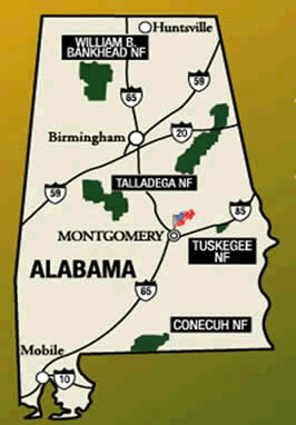
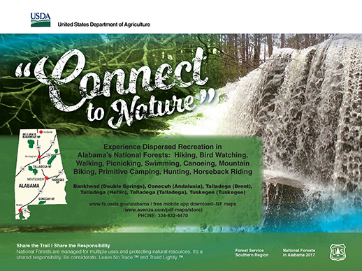
Tuskegee National Forest
Planning to visit the Tuskegee National Forest? Know Before You Go and Plan Your Trip.
In case of emergencies and/or road-side assistance, please contact 911.
2024 Recreation Fees and Opening Dates
Closures
- FSR 906 is open.
- The Bartram Trail from Macon CR 53 north to the parking area on FSR 900 is back open.
- The Chutkee Okhussee and Thloko Okhussee fishing ponds will be temporarily closed for the youth fishing derby from June 12 through June 22.
Notices
Due to recent personnel changes, the range of walk-in services offered at the Tuskegee NF office will be limited for now. This change will include the sale or issuance of Interagency passes, Senior passes, Military passes, etc., and map sales. Please call the Tuskegee office at 334-552-3145 before visiting for these types of services so that we can make arrangements to serve you. Many of these services are available online or at our Supervisor’s Office at 2946 Chestnut St., Montgomery, AL 36107 or 334-832-4470. (Date: 9/29/23)
Permits for Firewood and Forest Products
Permits for firewood and forest products are available at the Tuskegee Ranger District.
Uchee Shooting Range Maintenance Schedule
The Tuskegee National Forest will close the Uchee Shooting Range for up to 4-hours on certain days throughout the year for necessary maintenance. Help us keep this popular recreation site safe and fun for all visitors. Properly dispose all litter before leaving the shooting range. Please refer to the schedule below for specific months, days and times. Contact the Tuskegee District (M-F) at 334-552-3145 or visit the Forest Service website at www.fs.usda.gov/alabama for information regarding shooting passes. For emergencies, dial 911.
- October 1 - March 31 between the hours of 8:00 a.m. - 12:00 p.m. on Mondays
- April 1 - September 30 between the hours of 8:00 a.m. - 12:00 p.m. on Mondays or Tuesdays
Uchee Shooting Range Pass Vendors
Recreation
Below is an overview of the activities offered at Tuskegee National Forest. You will find additional information in the Recreation Activities section.
For detailed information on hunting in the National Forests in Alabama and Alabama’s Wildlife Management Areas, please visit the Official Web site of Alabama Department of Conservation and Natural Resources.
Map Purchases
On-line
- Available for purchase online at the U.S. Geological Survey Store.
- For those using the Avenza app, many Forest Visitor Maps are also available for purchase as georeferenced PDFs on Avenza, for use on mobile devices.
Maps on the Go!


- Need a Mobile Map? Get the Alabama Great Escapes App! Keyword - National Forests in Alabama. Category - Parks, Forests and Grasslands
Free Downloadable Maps
Taska Recreation Area
This is a must stop recreation area in the Tuskegee National Forest. Taska Recreation Area offers picnicking and sanitary facilities. Taska Recreation Area is open year round and offers facilities for the physically challenged. Taska is a daylight use area only.
Motor Vehicle Use - Have questions about motorized vehicles in the National Forests in Alabama? Know Before You Go...Travel Tips Q&A
Uchee Shooting Range
List and information of locations where Day and Annual Passes can be purchased for the Shooting Range.
Campgrounds
Designated camps are located at 14 sites in the Tuskegee National Forest, the designated camps are open year round and offer primitive camping. Visit the Tuskgee Ranger District office to obtain a camping permit.
Hiking
Bartram National Recreation Trail
The scenic Bartram Trail is the first trail in Alabama to be designated a National Recreation Trail. The trail runs through the Tuskegee National Forest for about eight and one half (8 1/2) miles. The Bartram Trail passes through various types of forest wildlife habitat. Trail hikers can see a wide variety of wild flowers and flowering trees, including dogwood and magnolias. Bartram Trail hikers may also get fleeting glimpses of deer, turkey, or other wildlife as they scurry through the forest.
Pleasant Hill Trail
Pleasant Hill Mountain Bike Trail is a hiking and biking trail in Macon County, Alabama. It is within Tuskegee National Forest. It is 3.8 miles long and begins at 303 feet altitude. Traveling the entire trail is 7.7 miles with a total elevation gain of 750 feet. The Hickory Grove Church (elevation 502 feet) place of worship and the Hickory Grove Cemetery (elevation 482 feet) grave yard can be seen along the trail. This trail connects with the following: Bartram National Recreational Trail.
Horseback Riding
Bold Destiny/Bedford Cash Memorial Trail
The Bold Destiny/Bedford Cash Memorial Trail in Tuskegee National Forest offers 15 miles of riding pleasure in the northern half of the forest. The trail winds through the rolling upland sand hills and traverses managed forest land where riders and hikers see planted pines ranging from 1 to 50 years old. At some stream crossings, hardwoods ranging from 80 to 90 years old can be seen. Bedford/Bold Destiny Trail-History
History of the Tuskegee National Forest
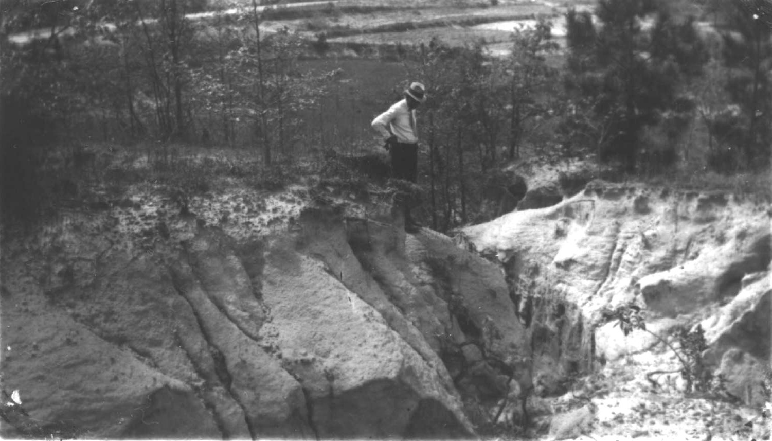
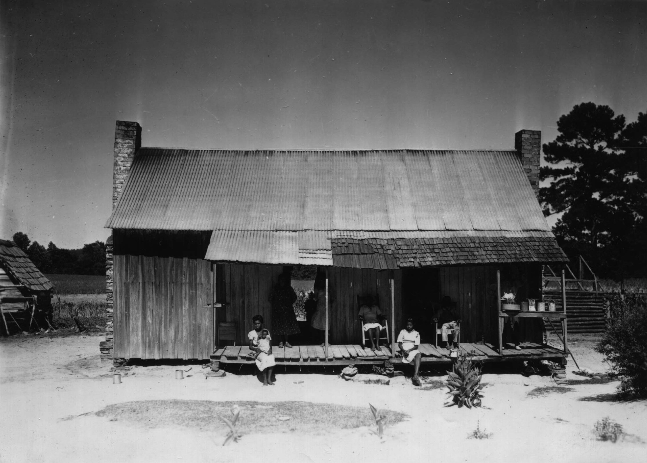
Although Macon County is one of the “Black Belt” counties of Alabama, the true Black Belt soils are only located in the southern portion of the county. The sandy hills north of the town of Tuskegee, subject to severe erosion, were soon found out to be unsuitable for agriculture. In 1901, Tuskegee Institute had attempted to assist African American families living on this poor soil. Through a program known as “The Big Hungry” private funding was used to move the families onto a four thousand acre area, homes were built, financial aid and educational facilities were provided. In spite of these opportunities, the families could not survive on the infertile soil and the program failed.
On December 5, 1934, Dr. Robert R. Moton, president of Tuskegee Institute, met with Dr. William A. Hartman, the regional director of the Agricultural Adjustment Administration (AAA), Land Policy Section; Ray Crowe of the AAA; and the board of directors of the Alabama Rural Rehabilitation Corporation, consisting of Thad Holt, R.K. Greene, Donald Comer, Thomas Cannon, A.P. Morgan, and H.C Ryding to initiate a “Planned Land Use Demonstration project with a Rural Rehabilitation feature (Resettlement Project) in Macon County. On December 7, 1934, Director Hartman, R.T. Thurston, the local Count Extension Agent, and T.M. Campbell, field agent for the U.S Department of Agriculture conducted an inspection of the proposed submarginal project area. They observed conditions of “human and land poverty.” On December 9th, Dr. Hartman met with local workers and outlined a planned to be submitted to Washington, D.C. A “Preliminary Report” was submitted to Dr. Hartman by local citizens. It proposed acquisition of 40,000 acres of submarginal land at five dollars per acre, and a resettlement site of 20,000 acres at fifteen dollars per acre. Tuskegee Institute was designated as the administrative agency for the Land Utilization and Resettlement projects.
 The project was approved on January 14, 1935. Thomas N. Roberts was assigned as the project manager. Roberts reported for duty on February 8th and the greater portion of his staff reported for work on March 1, 1935 and began land appraisals of the project area. On April 18, 1935, The Tuskegee News reported that a meeting had been held at the county court house. Signatures were obtained from local landowners agreeing to sell their land to the government for 25,000 of the proposed 40,000 acres of submarginal land which would be taken out of farming production and used for reforestation, game and fish preserves, pastures and recreation centers. The Tuskegee Land Use Demonstration Project would also offer employment for many of the people living within the project area.
The first plan for the Tuskegee Project was submitted to Washington, D.C. on April 23, 1935. By August, options had been obtained for 33,561 acres, but the project area was reduced down to 10,000 acres by executive order on August 29th. The final plan was submitted on September 18th and approved by the Resettlement Administration on October 8, 1935.
The Resettlement Administration was one of the New Deal agencies of President Franklin D. Roosevelt. It was created on April 30, 1935 by executive order. It consisted of four programs. The Land Use Program took substandard and submarginal land out of crop production and converted it to best use. The Resettlement Program relocated families living on the submarginal land being purchased, providing them with adequate farmland and homes. The Rehabilitation Program worked to restore the credit of indigent farmers on suitable farmland. Finally, the Suburban Program built communities on the outskirts of urban areas for low-income city workers and suburban farmers.
The project area was described in the “Preliminary Plan for Land Acquisition” dated April 30, 1936. The land was “hilly with occasional rolling, gentle rolling, flat plains.” Erosion had robbed the land of its fertility and wealth. Most of the timber had been removed. Crop land and woodlands made up the major portion of the area, each at approximately 45 percent; however the woodlands were cutover with secondary growth and scrub oak. Pastures and wasteland made up the remaining ten percent. Approximately half crop land was planted in cotton, with corn as a second crop. A subsequent report, entitled “Land Acquisition Plan (Complete),” stated that the hillsides were deeply scarred from soil erosion, and the valleys were, for the most part, filled with sand. Sand, gravel, and silt from the hillsides had washed into the streams and destroyed the fish and aquatic life.
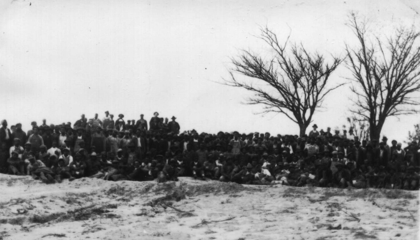 On April 2, 1936, The Tuskegee News had reported on the progress of the project. There had been 139 families living within the project area, totaling about 500 people. They would be given the opportunity to resettle on better suited land and assistance in purchasing a small farm. Some of the people would be given rehabilitation aid on better tracts of land, while others would be given employment on the project. By March 21, 1936, more than 300,000 longleaf, loblolly, and slash pine, locust, Osage orange, and white oak seedlings had been planted on the project area. Twelve miles of truck trails and park roads had been constructed, with bridges built over the streams. A forest nursery of 20 acres was planned. Five acres were to be seeded with pine, oak, elm, magnolia, and other species common to the area. The project work had begun on December 9, 1935 with 35 workers. As of March 1, 1936, there were 350 workers each day. The WPA office cooperated in the selection of workers, taken from the relief rolls. Rural Rehabilitation clients and Land Use clients whose land had been options to the government were also given employment.
In March 1937, Project Manager Roberts compiled a report entitled, “Tuskegee Development Project, LD AL 8, Background and Development Progress.” During the 1937 planting season, 587,170 seedlings were planted, including longleaf, loblolly, and slash pine, white oak, red river oak, cow oak and live oak. This brought the total planting accomplishments to 960,416 seedlings on 947 acres. The five-acre nursery had produced 134,188 oak and pine seedlings that were planted on the project area. It was estimated that one million seedlings would be produced during the 1937 season.
 To control forest fires, 29 miles of firebreaks had been constructed, and 10.8 miles of fire hazard reduction had been completed along the roads in the project area. Approximately 1,000 acres of forest stand improvement had been accomplished, including the removal of “wolf trees” and undesirable species, and fallen trees and debris that could add to the fuel loads. A fire patrol system had been established with a fire truck and a watchman. During the 1936-1937 season only 50 acres of the project area had effected by forest fire.
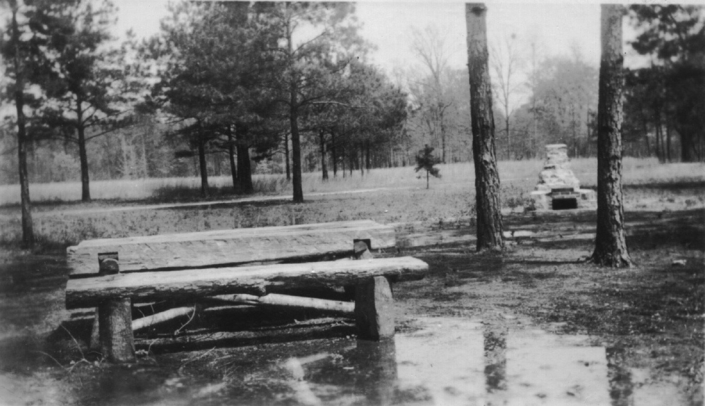
Recreational development was of interest to the people of Tuskegee and surrounding communities. Two picnic and campground areas were under construction. A 35-acre area equipped with A-type shelters, outdoor ovens, picnic tables and benches and a baseball field was under being built for African Americans, and a similar 25-acre area was to be built for white people. Three wayside parks were also under construction. With the fire protection measures introduced in 1936, a rapid increase in wildlife had been noticed. Quail, dove, squirrel, rabbits and other small game had increased over 200 percent. A flock of wild turkeys had settled in the project area.
During 1936, a total of 2,650 workers had been employed by the project, with an average of 221 workers per month. The project had five trucks, one caterpillar tractor, one grader, one station wagon, and one pickup fire truck assigned to the project. The project had over 1,000 pieces of equipment including shovels, posthole diggers, trowels, hammers, axes, picks, brush hooks, fire rakes, and hoes.
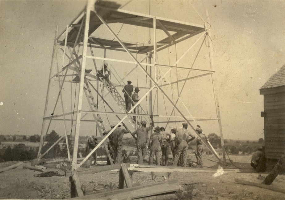
 On November 1, 1938, the relatively new Soil Conservation Service was assigned the administration of the three Land Utilization Projects in Alabama (West Alabama LUP, now the western half of the Oakmulgee Ranger District; Tuskegee LUP; and the Pea River LUP, now part of Fort Rucker). On that date, a master plan development plan was prepared by Project Manager Roberts and Tuskegee President Frederick D. Patterson. It was mailed on December 1, 1938 to Dr. Hartman, now the regional director for the Soil Conservation Service in Atlanta, Georgia. The report listed the work accomplished through November 1, 1938. Completed work at the towerman’s unit at Pleasant Hill included construction of a barn, chicken house, hog house, smoke house, dwelling, garage, woodshed, sewer system, landscaping, and fencing. Constriction of the 100-foot fire tower was 97 percent completed. Seventeen temporary bridges had been built on the project area. Forestry work included the collection of 2,000 bushels of seed and forest stand improvement on 1,000 acres. Thirty-five miles of truck trails had been constructed with 50 temporary and 65 permanent culverts. Thirty miles of firebreaks had been constructed and fire hazard reduction work had been accomplished over the entire project area. Five thousand check dams had been built with 500 rods of diversion ditches. Thirteen A-type shelters with ten fireplaces and 24 picnic table and benches combinations built across the area.
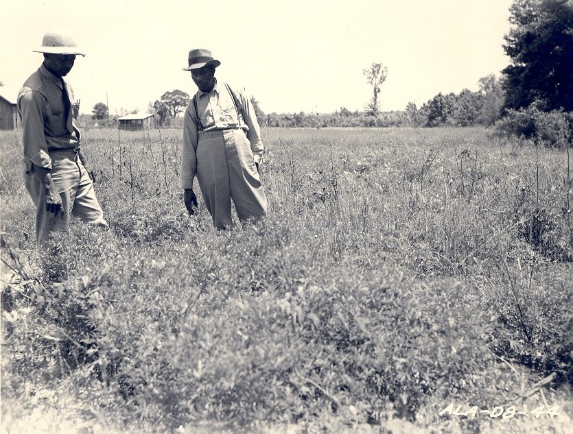
The Soil Conservation Service (SCS) supervised the Tuskegee Land Utilization Project from 1939 to 1949, continuing the work started by the Resettlement Administration in 1935. In late 1939, the Department of Agriculture approved Tuskegee Institute to take over management of the project. However, Tuskegee Institute did have the funds to take the responsibility. Through 1943, the Soil Conservation Service sought the funding to accomplish the work outlined in a 1939 report needed “to complete the project.” Budgets remained modest. Other than salary, most of the funding during these years was for maintaining the existing recreational facilities, infrastructure, and equipment. Permanent pastures were established and the planting of trees continued across the project area. In the early 1940s, greater emphasis was placed on unit workers demonstrating good land use and management on their assigned units.
In October of 1944, Alabama Polytechnic Institute (API) expressed interest in obtaining custody of a 5,000 acre portion of the project area for use by its forestry and horticulture departments. Tuskegee Institute’s President Patterson gave his approval of API using 5,000 acres of the project area for teaching purposes, however, Tuskegee Institute was anxious to use the same area for their own forestry and land use programs of instruction. On October 31, 1944, Dr. Hugh H. Bennett, chief of the SCS in Washington, D.C. wrote to the regional conservator in Spartanburg, S.C. that due to previous commitments by the Department of Agriculture to Tuskegee Institute, the SCS could not allow API to take over management of portions of the project area.
On April 1, 1945, Tuskegee Institute prepared a “Report on Tuskegee Development Project.” The plan divided the project area into eastern and western areas and developed work plans for grazing, wildlife management, fire control, and administrative facilities. The plan included an appraisal of the timber on the project area and the expected income from grazing permits. These projections suggested that the project was approaching a stage where it could pay for itself.
 On October 14, 1949, the Soil Conservation Service leased the project area to the East Alabama Soil Conservation District for a period of ten years. The East Alabama Soil Conservation District continued to promote soil conservation work. They encouraged grazing, hay cutting, cropping, and timber cutting to demonstrate proper land use practices. On July 1, 1952, a “Preliminary Forest Management Plan” was written. At this time, the project area consisted of 8,656 acres of forest land of varying degrees of stocking and types. The remaining 2,124 acres was in pasture, cropland or idle. There were 5,733 acres classified as pine type, where pines or a mixture of pines made up 75 percent or more of the area. The pure pine stands had developed primarily in abandoned cropland or old open fields. There were 669 acres of pine-hardwood type along the lower slopes adjacent to streams. Most of the project area was well-stock, however, it was noted that much of the area was stocked with undesirable species of hardwoods.
On January 1, 1954, the Tuskegee Land utilization Project was transferred from the Soil Conservation Service to the Forest Service under the provisions of the Department of Agriculture Reorganization Act. The lease to the East Alabama Soil Conservation District remained in place. On September 30, 1955, Project Conservationist Thomas E. Pace submitted a “Timber Management Policy Statement” for the Tuskegee Land Use Project. At this time the project contained 10,780 acres, with 2,123 acres in pasture, cropland, roads, water and idle land; and another 8,658 with some type of forest cover. There were five farm units maintained on the project by part-time laborers. The statement included a timber sale policy. It was expected that 400,000 board feet could be cut from the area each year.
All through the 1950s there was discussion on the disposition of the project area. Alabama Polytechnic Institute was still interested in acquiring management of the project, as was Tuskegee Institute, but Tuskegee Institute lacked the funding to take over the project. The people of Macon County, however, wanted the project area to remain in federal ownership. The county received a percentage of the revenue generated from timber sales and grazing permits. By 1955, the annual returns were averaging three to five times the amount received when the land was taxed. On November 27, 1959, President Dwight D. Eisenhower created the Tuskegee National Forest by presidential proclamation.
For more information on the history of the Tuskegee Land Utilization Project, read:
Planting Hope on Worn Out Land, History of the Tuskegee Land Utilization Project, Macon County, 1935-1959. By Robert G. Pasquill, Jr., New South Books, 2008.
Robert G. Pasquill, Jr.
National Forests in Alabama
Forest Archeologist and Historian (Deceased)