Official websites use .gov
A .gov
website belongs to an official government organization in the
United States.
Secure .gov websites use HTTPS
A lock
(
) or https:// means you've safely
connected to the .gov website. Share sensitive information only
on official, secure websites.


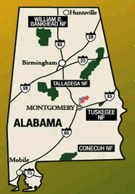
Shoal Creek Ranger District
Alert: Forest Service Road 523 Closure
Public access using Forest Service Road 523 is currently closed until further notice. An alternate route is to travel US Hwy 78 to Forest Service Road 500.
Planning to visit the Talladega National Forest? Know Before You Go and Plan Your Trip
In case of emergencies and/or road-side assistance, please contact 911.
2024 Recreation Fees and Opening Dates
News
Talladega National Forest – Talladega District (Access to FSR 600-2)
The USDA Forest Service secures and protects the public's rights, titles, values, and interests in national forests. A thorough title search has determined the United States does not hold an easement or right-of-way of record across the Southeastern Land Group property located at the intersection of Skyline Drive and Union T. Road - commonly referred to as Forest Service Road 600-2 - in Talladega County. We encourage recreationists to know before they go, by checking their intended destination and the open Forest Service roads to ensure use of lands within our jurisdiction.
Contact Talladega District Office at 256-362-2909 or visit: www.fs.usda.gov/alabama. Providing access to public lands is an important component of the Forest Service mission
Information
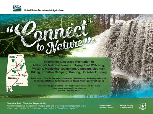
Below is an overview of the activities offered at Shoal Creek Ranger District - Talladega National Forest. You will find additional information in the Recreation Activities section.
For detailed information on hunting in the National Forests in Alabama and Alabama’s Wildlife Management areas, please visit the Official Web site of Alabama Department of Conservation and Natural Resources.
Motor Vehicle Use - Have questions about motorized vehicles in the National Forests in Alabama? Know Before You Go...Travel Tips Q&A
Map Purchases
On-line
- Available for purchase online at the U.S. Geological Survey Store.
- For those using the Avenza app, many Forest Visitor Maps are also available for purchase as georeferenced PDFs on Avenza, for use on mobile devices.
Maps on the Go!

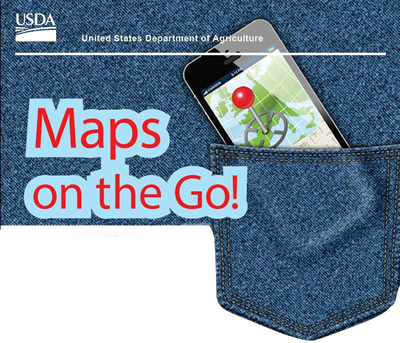
- Need a Mobile Map? Get the Alabama Great Escapes App! Keyword - National Forests in Alabama. Category - Parks, Forests and Grasslands
Free Downloadable Maps
Campgrounds
Users have a choice of two developed campgrounds, shelters along the Pinhoti Trail, and several primitive hunter camps. Primitive camping is also allowed throughout the forest except during the gun deer season when it's restricted to the camping areas. Special permission to camp during gun deer season can be obtained from the local district office.
Coleman Lake Recreation Area
The newly renovated Coleman Lake Recreation Area is peacefully nestled into the Talladega mountains. For recreationists who want to get away from the crowds, but want a few modern conveniences, Coleman Lake Recreation Area is your place to be. There are 39 campsites with water and electrical hookups, bathhouses, 29 picnicking units, a 21-acre lake and access to the Pinhoti Trail. Two new comfort stations and seven camping sites are fully accessible for the physically challenged. Most sites will accommodate recreational vehicles up to 35 feet in length. A picnic shelter that seats 40 is available on a first come, first serve basis, or it can be reserved for $15. The lake is closed to fishing until Fall of 2017.
Pine Glen Recreation Area
This popular area is adjacent to a mountain stream and offers 21 campsites, cooking grills, sanitary facilities, picnicking, fishing, hiking, and access to the Pinhoti Trail. Pine Glen Recreation Area is a favorite with hunters because it is centrally located in the Choccolocco Wildlife Management Area.
Warden Station Horse Camp
This camp is convenient for horseback riders and provides an opportunity for hiking and 45 campsites with sanitary facilities and water. Warden Station Horse Camp is open year round.
Hunter Camps
Enjoy the forest and the wonders of nature in primitive camping surrounding. Pendergrass, Skeeter Branch & East End Hunter Camps are centrally located and open year round. These Hunter Camps have no sanitary facilities.
Big Oak Hunter Camp is our only physically disabled hunting area. This camp is a 1700 acre hunting unit for physically disabled hunters possessing the required State permits in Choccolocco Wildlife Management Area. Big Oak Hunter Camp also has sanitary facilities.
Hiking
The Pinhoti Trail includes more than 100 miles of hiking trails that runs from Piedmont, its northern terminus, to a point south of Talladega. The trail winds through rugged pine and hardwood forests, runs along ridgetops, passes through shady hollows and along mountain streams. The Pinhoti Trail meanders through mountains and valleys which are rich in history and legend. It's a land where Creek and Cherokee Indians fought over the disputed boundary between their nations and a land visited by De Soto in his exploration of the New World.
Side trails in the Cheaha Wilderness and Cheaha State Park are a part of the Pinhoti Trail System. They include the Nubbin Creek, Odum Scout, Cave Creek, Skyway Loop, and Chinnabee Silent Trails.
The Warden Station Multiple Use Trails (Red, White and Yellow) are now open and the Blue Trail remains closed.
Wilderness
Dugger Mountain Wilderness is a picturesque view of nature and tranquility. Dugger Mountain, the second highest peak in Alabama, has an elevation of 2,140 feet. Located between Piedmont and Anniston, it encompasses some of the most rugged mountainous terrain in Alabama, as well as numerous endangered and threatened plant communities.
History
A Brief History of the Shoal Creek Ranger District
(Note: Prior to 1945, the Talladega Division was managed as a single unit. See the Talladega Ranger District history for early development of the Talladega Division.)
The passage of the Weeks Act in 1911 had authorized the Forest Service to acquire land to protect the headwaters of navigable streams in the eastern United States. On June 7, 1924, Congress passed the Clarke-McNary Act. The Clarke-McNary authorized the Forest Service to acquire lands beyond the headwaters of navigable streams. In addition, it made it easier for the National Forests to acquire land from private sellers within predetermined forest boundaries, enabled the Secretary of Agriculture to work with state officials to better protect forests, provided for a continuous production of timber, and facilitated cooperative work between the USDA and private land owners by distributing tree seedlings and providing forestry assistance to farmers.
 On January 21, 1935, the National Forest Reservation Commission approved the Talladega Purchase Unit. The total area within the purchase unit consisted of over 422,000 acres in Calhoun, Clay, Cleburne and Talladega counties. Within this area was land that had been purchased for the developed for Cheaha State Park. The boundaries of the purchase unit were laid out along the Talladega Mountain range, excluding as much possible farmland as possible and including as much submarginal farmland, that is, lands not suited for farming, as possible. According to a reconnaissance report written by Wingate I. Stevens, approximately 72 percent of the land had been cut over. Twenty-eight percent still retained merchantable timber, but it had been culled over until only a light stand of saleable timber remained.
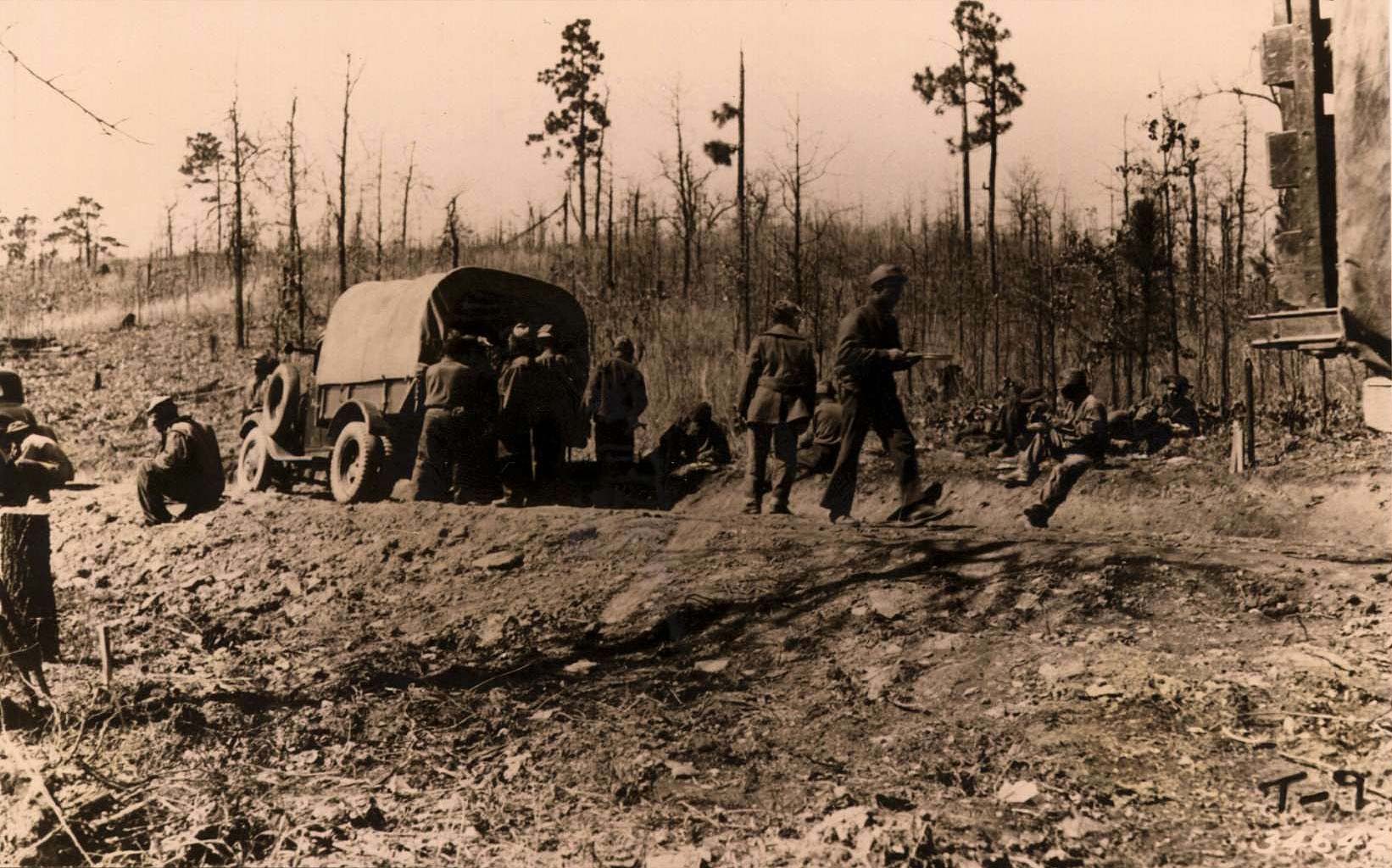
On August 28, 1935, Our Mountain Home (Talladega, Alabama) reported that another 9,045 acres of land had been approved for purchase by the federal government at a cost of $20,356.50. This brought the total amount of approved acreage in the Talladega Purchase Unit up to 124,000 acres. In addition to two CCC camps on the unit, whose primary work project was the construction of a 75-mile Scenic Highway running the length of the purchase unit, there were also 50 relief laborers from Talladega County engaged in improving tributary roads. The staff of the Talladega Unit had been increased to 30 men, with 15 men assigned to field work out of the Forest Service headquarters in Talladega, and another 15 men assigned to the supervision of the CCC workers in the two camps.
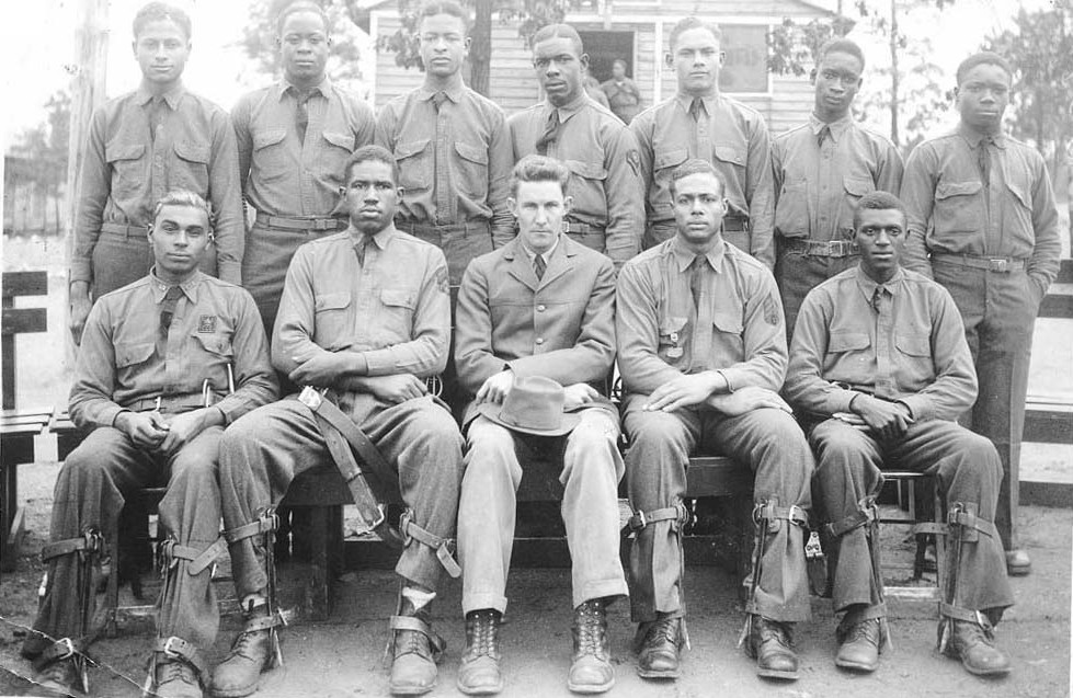
 The creation of the Civilian Conservation Corps was critical to the development of the Talladega National Forest. The Cleburne News reported on May 6, 1935 that W.R. Silcocks, of the U.S. Forest Service in Talladega, had visited Heflin looking for a suitable site for a CCC camp. Meeting with local officials, a site was selected on the south side of town. According to the article, Congressman Joe Starnes was largely responsible for getting a CCC camp in Cleburne County. CCC Company 3477 established Camp F-6 at Heflin on July 17, 1935. The company was made up of “junior” African American enrollees, that is, young men between the ages of 18 and 28, from Alabama, Florida and Louisiana. The camp was located on 20 acres of leased land.
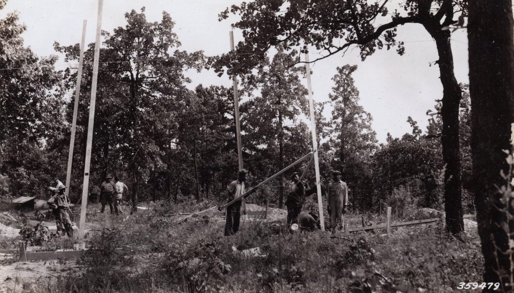
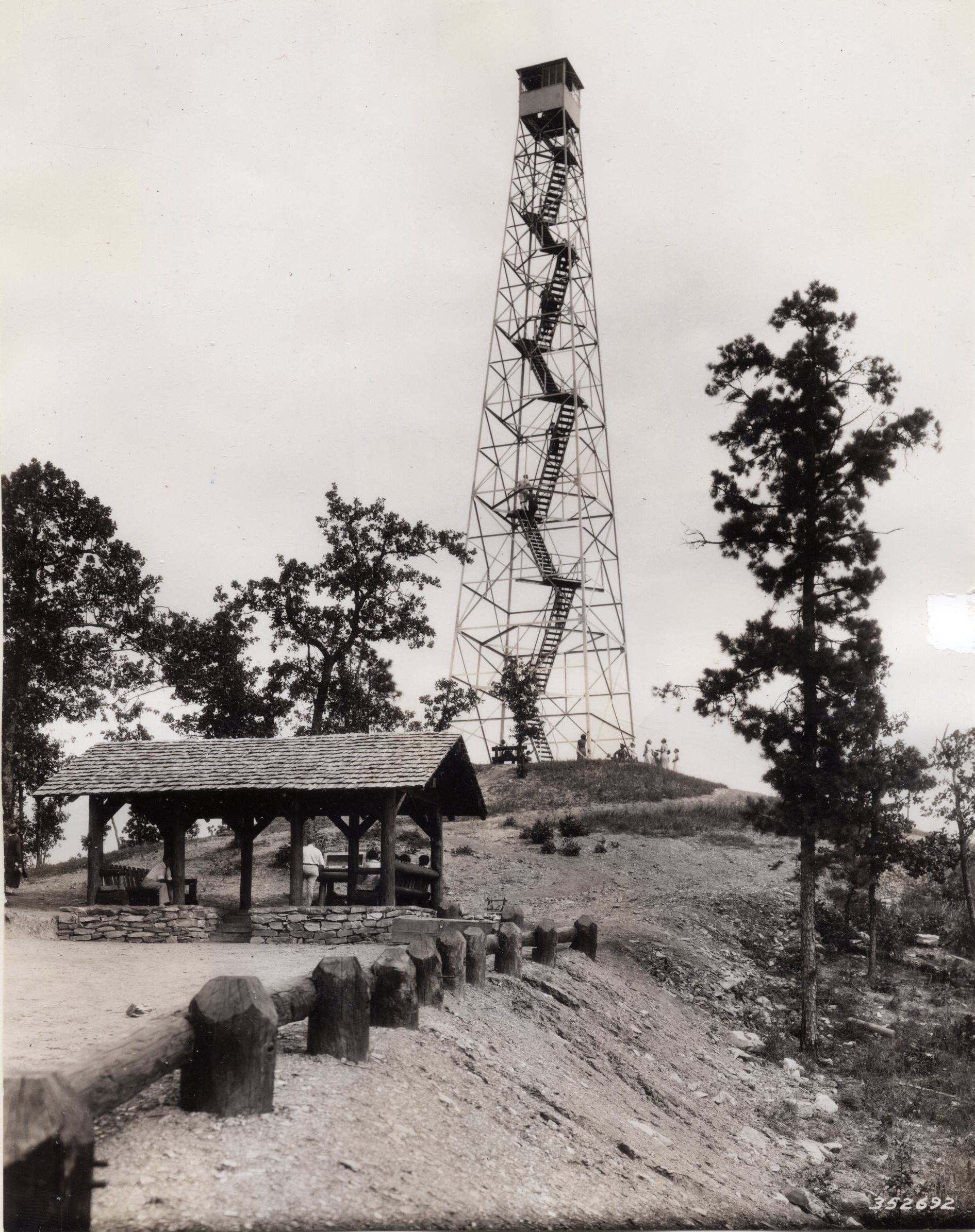
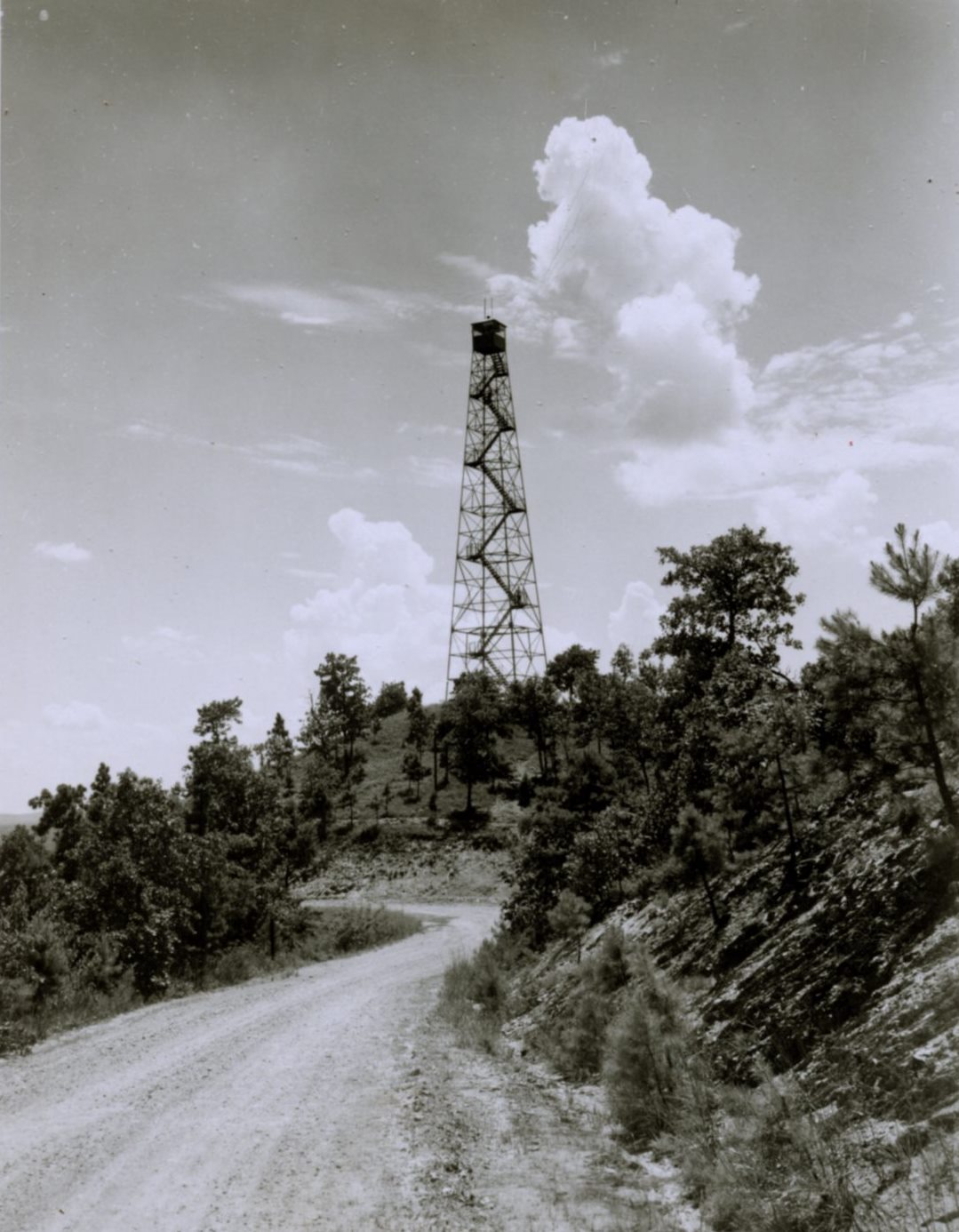
Working on the northern half of the Talladega National Forest, the primary work project goals for CCC Company 3477 was to make the forest area more accessible and construct a series of fire towers connected by telephone lines. These first two goals were necessary to accomplish the third goal: protecting the forest area from forest fires. The project that would take most of their time was the construction of the Sky Way Motor Way. On August 1, 1935, The Cleburne News reported that the Forest Service was constructing a 75-mile scenic road running along the crest of the main ridge of mountains in the Talladega National Forest. Company 3477 began their portion of this construction project north of Cheaha State Park and worked northwards towards Piedmont. The Official Annual of District “D”, Fourth Corps Area, Civilian Conservation Corps, 1936 reported that about 17 miles of the “Sky Way Motor Way” had been located, opened and graded. According to the 1936 annual, when finished, the road would be one of the most beautiful scenic routes in Alabama and the South.
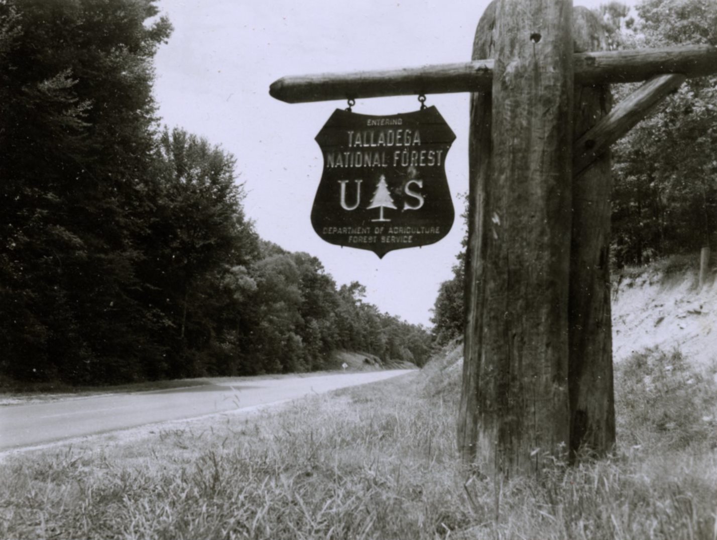
 On July 17, 1936, the Talladega National Forest was created by presidential proclamation by Franklin D. Roosevelt. Initially, the Talladega Division of the Talladega National Forest was managed as one unit. In 1945, the unit was divided with the Shoal Creek Ranger District being that portion north of Cheaha State Park and headquartered in Heflin.
A Camp Inspection Report from Camp F-6 dated November 5, 1937, recorded the company strength at 251 men. The enrollees were from Alabama, Florida and Louisiana. The work project was widely scattered over 160,000 acres, with the primary project being road construction. The work project also included construction of bridges, fire towers and telephone lines, and the maintenance of roads. Forest stand improvement, landscaping and campground development rounded out the project work. The report stated that fieldwork from Camp F-6 had begun on August 12, 1935, and estimated that approved work projects would be completed in six months. However, the work being conducted could be carried on indefinitely.
By September of 1939, the road construction project of the “Sky Way Motor Way” had been completed from the Atlanta Highway (modern US Highway 78) to Cheaha State Park. Work continued on the scenic road from the Atlanta Highway north towards Borden Springs. The Camp Inspection Report dated September 9, 1939, stated that the travel time to the work project was excessive. Plans had been made to transfer Camp F-6 to a new location, Camp F-12, approximately 21 miles to the north. By September 9, 1939, the buildings of Camp F-6 were being dismantled, to be transferred to Camp F-12. According to the “Historical Record of CCC Camp Buildings” the transferred of all of the structures of Camp F-6 to Camp F-12 was completed by October 11, 1939.
 On September 22, 1939, The Piedmont Journal (Piedmont, Alabama) reported that the work project for Company 3477 was to be primarily on construction of the scenic highway known as the “Sky Way Motor Way,” running from Cheaha State Park. They were working on the portion extending to Borden Springs, which had already reached a point within a couple of miles of Grantley.
Camp Choccolocco, Alabama F-12, was established on October 1, 1939. By October 11, 1939, the structures from Camp F-6 had been dismantled and relocated to the new campsite, which was located near the small community of Grantley, approximately 12 miles southeast of Piedmont, Alabama. The camp was 16 acres in size, situated on Forest Service land.
CCC Camp F-12 was abandoned on July 11, 1941. Company 3477 was transferred to CCC Camp P-77 at Uriah, Alabama, where it worked on a private forestry project.
The Civilian Conservation Corps ended on July 1, 1942. The next big push of recreation development in the National Forests came in the 1960s with the signing of the Public Works Acceleration Act on September 14, 1962 by President John F. Kennedy. The purpose of the Act was “to initiate and accelerate Federal public works projects and to provide Federal assistance for a similar expansion of public works to relieve unemployment and spur economic expansion in those areas of the country which have failed to share fully in the economic gains of the recovery from the 1960-61 recession.”
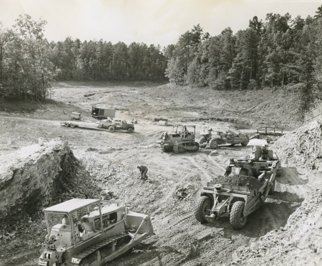
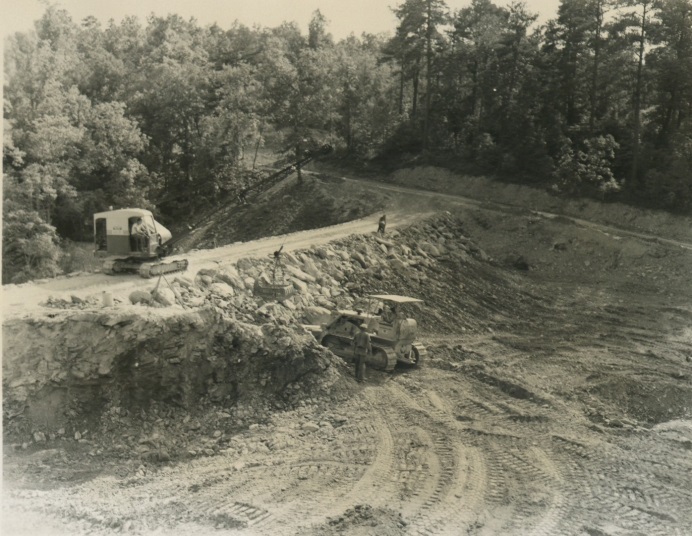
 Construction work on Coleman Lake began in 1964 with funding from the Public Works Acceleration Act. Cleburne County was identified as being eligible for funding under the Act. On May 26, 1966, The Cleburne News (Cleburne County, Alabama) reported that Coleman Lake would be open for fishing on June 1, 1966. The article stated that although Coleman Lake was located on National Forest land, the area was not presently a federally designated area subject to recreation user fees. There were to be no special charge for fishing. The creel limit was set at six bass and 20 bream per person per day, and all other State of Alabama Fishing Laws applied. It appears from the article that at this point there were no camping or bathing facilities, or any other improvements at Coleman Lake that would make the lake qualify for user charges as a Federal Recreation Area under the Land and Water Conservation Fund Act of 1965. While the lake was opened to the public for fishing in June of 1966, development of the proposed campground was delayed. Construction of the camping facilities did not begin until August of 1968 and not completed for dedication until August of 1970.
 |
 |
Robert G. Pasquill, Jr.
National Forests in Alabama
Forest Archeologist and Historian (Deceased)