
Official websites use .gov
A .gov
website belongs to an official government organization in the
United States.
Secure .gov websites use HTTPS
A lock
(
) or https:// means you've safely
connected to the .gov website. Share sensitive information only
on official, secure websites.


Special Places
The Ochoco National Forest and the Crooked River National Grassland are home to many treasured landscapes and activites.
Come find your special place!
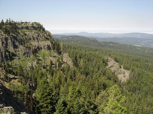
North Pisgah Point overlooking Bridge Creek Wilderness
Ochoco National Forest
Wilderness areas
 One of our nation's greatest treasures is the National Wilderness Preservation System established by the Wilderness Act of 1964. Wildernesses are lands designated by Congress to be protected and preserved in their natural condition, without permanent improvements or habitation.
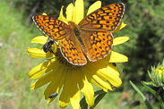
Wildflowers on display
Big Summit Prairie wildflower viewing
Paulina District driving scabland tour
Lookout Mountain
If you're looking for some great trails with views of the Blue Mountains to the east and the snow-capped Cascades to the west, try Lookout Mountain. Keep an eye out for wildlife and wild horses.
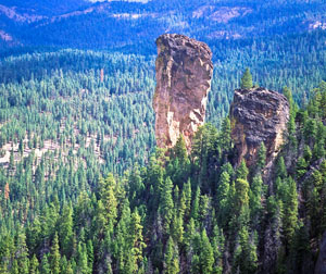
Stein's Pillar
The Stein’s Pillar trail is an easy four-mile roundtrip hike, about 20 miles from Prineville, which climbs through old-growth forest and along steep ridges to the base of Stein’s Pillar, a 350-foot monolith of welded tuff, deposited during the collapse of the Wilcat Caldera, around 40 million years ago. The pillar can also be seen from a viewing area along Mill Creek Road.
Bandit Springs Sno-Park
One of four Sno-Parks on the Ochoco National Forest. This one contains the highest density of Nordic ski trails.
Big Summit Wild Horse Territory
The Ochoco National Forest is home to a 25,434-acre Congressionally-designated wild horse territory. Learn more about this herd management area and the wild horses that inhabit it.

From atop Gray Butte looking west across the Grassland.
Crooked River National Grassland
The Island
The Island National Natural Landmark is located on an isolated plateau at the confluence of the Deschutes and Crooked rivers in east-central Oregon. This 208-acre site supports one of the best known and least disturbed examples of native juniper savanna located within the Columbia Plateau. The Island is also a designated Research Natural Area, and is jointly managed by the Bureau of Land Management and the U.S. Forest Service.
Rimrock Springs Wildlife Area
This little wetland oasis easily accessed from Highway 97 provides habitat for numerous bird species throughout the year, and includes a half-mile paved hike.
Gray Butte
Especially popular in early spring, when most national forest trails are under snow, Gray Butte provides majestic vistas of the Grassland, the Cascades, and the Blue Mountains, with trails that tie into Smith Rock State Park and BLM land.
Highlighted Areas
Alder Springs Trail (#855)

This trail descends into the canyon from the parking area at Alder Springs Trailhead. As it descends along the layered bluffs, visitors can see intriguing views of the canyon and the trail ahead.
At the base of the canyon visitors intending to continue on the trail must cross Whychus Creek. This crossing can vary in intensity from "quite exciting" to "rather tame" depending on the season.
Water levels tend to be higher and the flow faster in late spring and early summer; however, both elements tend to mellow out more toward late summer and early fall. As a wild un-dammed creek with headwaters high in the snowy Cascades, water levels can rise without warning, especially during rainy periods.
After crossing the creek, the trail continues downstream to the north following Whychus Creek, weaving up along the hillside and down into some brushy overgrown places, periodically offering some unexpectedly stunning views.
The developed trail ends where the Deschutes River and Whychus Creek meet.
View an Alder Springs Trail map.
Haystack Reservoir


