
Official websites use .gov
A .gov
website belongs to an official government organization in the
United States.
Secure .gov websites use HTTPS
A lock
(
) or https:// means you've safely
connected to the .gov website. Share sensitive information only
on official, secure websites.


Special Places
Special Places
Here are some of our favorite places on the Lassen National Forest. We hope that you enjoy them as much as we do!
Please note that pets must always be restrained or on a leash while in developed recreation sites, and that pets (except guide dogs) are not allowed in swimming areas.
Almanor Beach
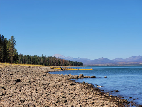
Photo of Almanor Beach, taken by Gabriel Hobson
With sweeping views of Mount Lassen and Dyer Mountain, Almanor Beach is the perfect place to have a picnic and go for a swim. With picnic tables, grills, and bathrooms this site has everything you need to enjoy Lake Almanor. The beach has buoys that protect the swimming area from watercrafts. No lifeguards are present at Almanor Beach.
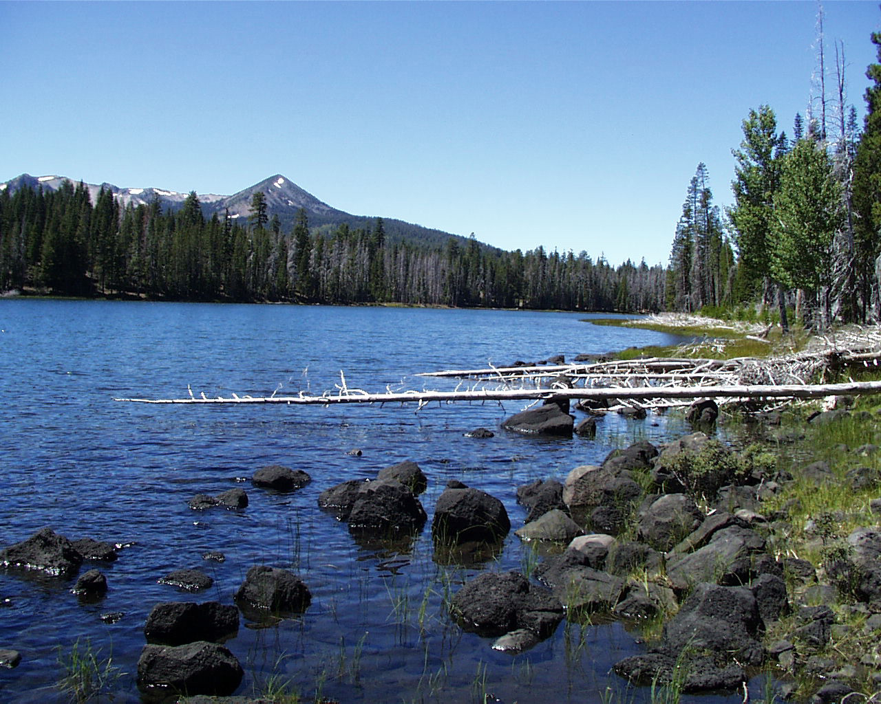
Crater Lake
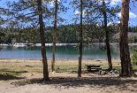
Campground located 7 miles off highway 44. Motor homes and large trailers not recommended due to rough steep road. There are 17 sites at lake, each site has a fire ring and table. Hand pumped water, vault toilets. Fly fishing, canoeing, and float tubing are favorites at Crater Lake. Fall season check out the display of colors our aspen stands contribute to the tranquility of the area. No gas motors on lake.
Deer Creek Trail
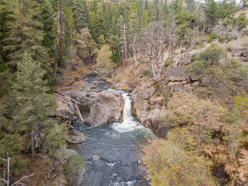
Photo of Deer Creek Falls, taken by Gabriel Hobson
This trail follows along the steep banks of Deer Creek, providing scenic views of the river below and the surrounding hillsides. The stream is some of the most important habitat for the threatened Central Valley spring run Chinook salmon. As you pass through the privately held Deer Creek Preserve you may observe salmon using the fish ladder which allows salmon and other fish navigate around Lower Deer Creek Falls and extend their habitat range. Great camping opportunities can be found on the trail where it is on Forest Service land. However, Deer Creek Preserve prohibits camping and campfires.
Dow Butte Lookout
Dow Butte Lookout is a former fire lookout now available for the public to tour and enjoy the view.
Gallatin Beach
Day use area near Aspen campground. Great for family fun, sandcastles, sunbathing, and swimming. No lifeguard on duty.
Hat Creek Rim Overview
Scenic overlook of the Hat Creek Valley. Interpretive site with access to the Pacific Crest Trail. Picnic tables and vault toilets are located at the overlook, but there is no running water.
Stop by for a stunning view, a picnic, or a stroll along the Hat Creek Rim on the Pacific Crest Trail.
Heart Lake Trail
This scenic National Recreation Trail climbs 3 miles along the creek to a beautiful mountain lake. There is another trailhead on the 17 road which allows a shorter 2 mile hike to Heart Lake. This trail continues another 6 miles, briefly passing through Lassen Volcanic National Park, leading to the trailhead on the 30N16 road. Enjoy peaceful birdsong and a stunning view of Brokeoff Mountain.
Ishi Wilderness
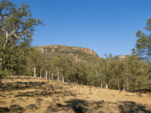
Photo of Ishi Wilderness, taken by Gabriel Hobson
Steeped in history and abound with wildlife, the 41,00 acre Ishi Wilderness offers wide open scenery and many recreational opportunities. The Lassen, Moak, Lower Deer Creek, Mill Creek Trails take hikers and equestrians along the ridgetops and through the deep canyons that the last of the Yahi Yana Indians once called home while they hid from settlers. Located mostly with a state game refuge, wildlife is abundant and landscapes are diverse. Some areas include wide open oak savannahs with towering hoodoos and sheer canyon walls, while other areas have mixed conifer forests that provide relief from the hot summer sun. As a designated wilderness no mechanized or motorized travel is allowed.
The Ishi is named for a Yahi Yana Indian who was the last survivor of his tribe, who lived in the area for over three thousand years. Shortly after 1850, the white settlers killed all but a handful of the Yahi. Ishi (the Yahi word for man) and a few others escaped and lived quietly for decades in this harsh, wild country. Read more about the Ishi's story.
When visiting the Wilderness, please respect this cultural heritage. Hunting is prohibited, but fishing is allowed with a valid California fishing license. Remember that all archaeological and historical sites and artifacts are protected by federal law and should not be disturbed.
Lake Almanor Recreation Trail
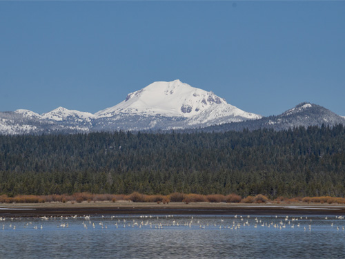
Photo of Lake Almanor, taken by Gabriel Hobson
Whether you want to get out for a long bike ride or go for a leisurely stroll, this 11 mile trail that follows the west shore of Lake Almanor makes for the perfect outing, with spectacular views of Lake Almanor, Dyer Mountain, and Lassen Peak. Stretching from Almanor West to Canyon Dam Boat Launch, this trail hugs the lake’s shoreline for much of its length and cuts through rolling pine forest in others. With many access points and easy access to Dyer View Day Use, Almanor Beach, and Prattville there are great opportunities for picnicking, migratory waterfowl viewing, or stopping off at a local café for lunch. The Lake Almanor Recreation Trail is closed to all motorized vehicles.
Legacy Campground
The newest campground on the Almanor Ranger District offers full hookup sites and easy access to the Lake Almanor Recreation Trail as well as the nearby Almanor Boat Ramp. Surrounded by a Jeffery pine forest and conveniently located a half mile from the lake, this campground offers the relaxation in the forest with easy access to the water and expanse of Lassen National Forest in almost every direction, yet it’s only minutes from the convenience of nearby restaurants and stores in Chester and Prattville.
McCarthy Point Lookout
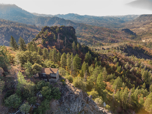
Photo of McCarthy Point Lookout, taken by Gabriel Hobson
Built in 1936 by the Civilian Conservation Corps on the rim of Mill Creek Canyon for lookouts to spot smoke from wildfires. A few years after its construction, during World War II, the lookout was used for monitoring for enemy aircrafts and Japanese incendiary devices that were attached to weather balloons. Today, McCarthy Point Lookout is used as a rental cabin where the public can enjoy warm days and cool nights from June to October. Located in a state game refuge deer, bear, and other wildlife are common sites in the area. With the 41,00 acre Ishi Wilderness only a few miles away there are many opportunities for hiking, wildlife viewing, and other actives nearby. This cabin is reservation only, and can be rented at https://www.recreation.gov/camping/campgrounds/234467.
Old Station Visitor Information Center
The Old Station Visitor Information Center is the hub of the Hat Creek recreation area. Here you can view interpretive displays including a living trout exhibit (seasonal) and delightful gardens. It is a pleasant stop to get answers to your forest questions. Maps, wood cutting permits, Christmas tree permits (Nov- Dec) nature books and interpretive items are available for sale.
Pacific Crest Trail
2,650 miles from Mexico to Cananda and by far the most popular trail in the west, the Pacific Crest Trail (PCT) runs right though Lassen National Forest and Lassen Volcanic National Park. Hat Creek Ranger District has 64 miles along mountain ridges, deep forests and open country. The views from this portion of the trail are outrageous -- Lassen Peak and Mt. Shasta! Elevations along the trail range from 3,200 to 5,500 feet. Portions of the trail are under snow until late spring. There is no water available for approximately 26 miles along the Hat Creek Rim.
Spattercone Nature Trail
Self-guided interpretive trail through the origin of the Hat Creek Lava Flow. See spatter cones, craters, and a beautiful view of the Hat Creek Valley. Loop trail, approximately 1.7 miles long.
Subway Cave
Explore the underground world of a lava tube. The self-guided trail (area is unavailable) is approximately 1/3 mile long and the cave is completely dark, so don't forget to bring a flashlight.
The floor is rough and jagged so wear sturdy shoes. A light jacket will ward off the chill as the cave remains a cool 46 degrees F. Neither hardhats nor crawling is required!
Pets are not allowed.
Thousand Lakes Wilderness
Located within the southern portion of the Cascade Mountain Range is 16,335 acres of contrasting topography. Thousand Lakes Wilderness is midway between the town of Burney and Lassen Volcanic National Park.
Volcanic and glacial formations, rocky ravines, mountain slopes, open meadows, and stands of lodgepole pine and red fir define the Wilderness. It is dominated by 8,677 foot Crater Peak, the highest point on the Lassen National Forest, and is a reminder of the glacial action that eroded Thousand Lakes Volcano and created the many small lakes and ponds scattered throughout. The lowest point in the Wilderness occurs at the base of the volcano at 5,546 feet.
The seven major lakes that lie within the Wilderness valley contain trout. Several species of wildlife make their home in the Wilderness. With a little luck and a good pair of binoculars you might spot some the more permanent residents; black-tailed deer, black bear, pika, pine marten, northern goshawk, spotted owl, pileated woodpecker, and Clark's nutcracker. Even elk have been known to visit occasionally.
Another critter worth mentioning is the mosquito. At times they are thick and hungry. It would be advisable to carry insect repellent in your pack.
The summer use period is approximately June 15 to October 15, although early spring could open up the lower areas by Memorial Day. Your experience will be enhanced and impacts will lessened by avoiding weekends and holidays, and heavily used areas.
For more special places, visit our Recreation page.
Highlighted Areas
Ashpan
Ashpan is open for the season.
Snowmobile staging area for the Ashpan Groomed Snowmobile System.
Bridge Day Use Picnic Area
Bridge Day Use Picnic Area is open again!
Bridge Day Use Area sits along the bubbling waters of Hat Creek. Picnic tables and barbeques are available. Great fishing opportunities.
Eskimo Hill
Winter sports area/snow sledding hill.