
Official websites use .gov
A .gov
website belongs to an official government organization in the
United States.
Secure .gov websites use HTTPS
A lock
(
) or https:// means you've safely
connected to the .gov website. Share sensitive information only
on official, secure websites.


Day Hiking
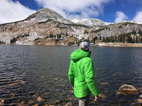 With hundreds of miles of trail, opportunities for day hikes abound across all areas of the Medicine Bow-Routt National Forests and Thunder Basin National Grassland. From a quick lap around a lake or rock outcrop after a picnic lunch to an early morning adventure catching the sunrise on a mountain peak, hikers of all skill levels can find a trail suited for them. Some trails are paved and accessible to all visitors, while others may have rocky terrain or patches of snow year-round. Use the links below to explore the many trails on the forests and grasslands and check with the local ranger district for the most current trail conditions.
Day Hiking Areas
- California Park/Black Mountain Area
- Adams Creek TH: Trail #1144.6A
- Adams Park TH: Trail #1144
- Aspen TH: Trail #1183.1A
- Black Mountain TH: Trail #1185
- California Park TH: Trail #1144
- Campground TH: Trail #1185
- Cottonwood TH: Trail #1183
- Dry Fork TH: Trail #1144
- Old Black Mountain TH: Trail #1144
- Roaring Fork TH: Trail #1144
- Sand Mountain TH: Trail #1175
- Sawmill TH: Trail #1144
- Sherman TH: Trail #1010
- Taylor Creek TH: Trail #1183.1B
- The Dike TH: Trail #1144
- The Gap TH: Trail #1144
- West Prong TH: Trail #1144
- Willow Creek TH: Trail #1144
- Flat Tops Area
- Allen Basin Trailhead
- Baldy Trailhead
- Bear Lake Campground
- Coal Creek/Sawtooth Trailhead
- Cyclone Trailhead
- Devil's Causeway
- Dunckley Pass Overlook
- Dunckley Pass Winter Trailhead
- East Fork Trailhead
- Elk Draw Trailhead
- Flat Tops Wilderness - Routt
- Gardner Park Trailhead
- Gill Reservoir Trailhead
- Heart Lake Trailhead
- Mandall Trailhead
- North Dunckley Trailhead
- Salt Park/South Fork Area
- Sheriff Reservoir Trailhead
- Smith Lake Trailhead
- Stillwater Trailhead
- Transfer Trailhead
- West Fish Creek Trailhead
- Yampa Ranger District Office
- Gore Range Area
- Lagunita Lake Trailhead
- Lower Sarvis Creek Trailhead
- Lower Silver Creek Trailhead
- Morrison Divide North Trailhead
- Morrison Divide South Trailhead
- Red Dirt Reservoir Recreation Area
- Rock Creek Trailhead
- Routt Divide Trailhead
- Sarvis Creek Wilderness
- Teepee Creek Trailhead
- Upper Sarvis Creek Trailhead
- Upper Silver Creek Trailhead
- Laramie Peak Area
- Campbell Creek Campground
- Cow Creek Trailhead
- Curtis Gulch Campground
- Curtis Gulch Trailhead
- Deer Creek Trailhead
- Douglas Ranger District Office
- Elkhorn Creek Trailhead
- Esterbrook Campground
- Friend Park Campground
- Harris Park Trailhead
- La Prele Guard Station
- Labonte Trailhead
- Laramie Peak Trailhead
- North Laramie River Trailhead
- Roaring Fork Creek Trailhead
- Sunset Ridge Trail
- Twin Peaks Trailhead
- Mount Zirkel/Park Range Area
- Beaver Creek Trailhead
- Big Creek Lakes Campground
- Buffalo Ridge Trailhead
- Encampment Tie Hack Trailhead
- Encampment Trailhead
- Grizzly Guard Station Parking Lot
- Hidden Lakes Campground
- Katherine Trailhead
- Lone Pine North Trailhead
- Lone Pine South Trailhead
- Mount Zirkel Wilderness
- Newcomb Creek Trailhead
- Parks Ranger District Office
- Percy Lake Trailhead
- Pitchpine Trailhead
- Rainbow Lake Trailhead
- Red Canyon Trailhead
- Seven Lakes Trailhead
- Tie Hack Historic Site
- Upper 3 Island Lake TH: Trail #1163
- North Routt County Area
- Burn Ridge TH: Trail #1100
- Coulton Creek TH: Trail #1188
- Diamond Park TH: Trail #1152
- Hahns Peak TH: Trail #1158
- Hinman TH: Trail #1177
- Lower 3 Island Lake TH: Trail #1163
- North Lake TH: Trail #1164
- Scott Run TH: Trail #1177
- Seedhouse TH: Trail #1101, CDNST
- Slavonia TH: Trail #1150/1161/1162
- Pole Mountain Area
- Blair Picnic Site
- Happy Jack Trailhead
- Headquarters East TH
- Pole Creek Dispersed Campground
- Summit TH
- Tie City Trailhead
- Turtle Rock TH
- Vedauwoo Campground
- Vedauwoo Designated Dispersed Campsites
- Vedauwoo Picnic Sites
- Sierra Madre Area
- Baby Lake Trailhead
- Big Creek Park Trailhead
- Big Creek-Holroyd Park Trailhead
- Bottle Creek Campground
- Bottle Creek Group Picnic Site
- Bottle Creek Trails
- Brush Creek/Hayden Ranger District Office
- CDNST - Deep Jack Trailhead
- CDNST - Pipeline Trailhead
- CDNST - Red Mountain Trailhead
- Commissary Park Trailhead
- East Fork - Encampment River Trail
- Encampment River Wilderness
- Green Mountain Falls Trailhead
- Green Mountain Trailhead
- Hog Park Campground
- Huston Park Wilderness
- Jack Creek Campground
- Jack Creek Crew Quarters
- Lost Creek Campground
- Purgatory Gulch Trailhead
- Snowy Range Area
- Brooklyn Lake Campground
- Brush Creek Trails
- Chimney Park Trailhead
- Corner Mountain Trailhead
- Crater Lake Trailhead
- Deep Creek Campground
- Deep Lake Trail
- Dipper Lake Trail
- French Creek Campground
- French Creek Canyon Trail
- Green Rock Parking Lot
- Green Rock Picnic Site
- Keystone Cabin
- Lake Owen Trailhead
- Lakes Trailhead
- Laramie Ranger District Office
- Lewis Lake Picnic Site
- Libby Lake Picnic Site
- Little Brooklyn Guard Station
- Little Laramie Trailhead
- Meadow Falls Trailhead
- Miner's Cabin Trailhead
- North Fork Campground
- Platte River Wilderness
- Quealy Lake Trailhead
- Rock Creek Trailhead
- Routt Access Trailhead
- Ryan Park Campground
- Savage Run Wilderness
- Sheep Lake Trailhead
- Silver Lake Campground
- Silver Lake Trailhead
- Six Mile Trailhead
- Snow Survey Cabin
- South Brush Creek Campground
- Spruce Mountain Fire Lookout
- Sugarloaf Campground
- Tie Hack Lower Trailhead
- Tie Hack Upper Trailhead
- Tipple Trail Trailhead
- West Lake Marie
- Steamboat Springs Area
- Base Camp TH: Trail #1101, CDNST
- Buffalo Pass
- Buffalo Pass TH: Trail #1101, CDNST
- Dry Lake TH: Trail #1160
- Elk Park TH: Trail #1118
- Fish Creek Falls TH: Trail #1102
- Hahns Peak/Bears Ears Ranger District Office
- Hot Springs TH: Trail #1169
- Mad Creek TH: Trail #1100
- Red Dirt TH: Trail #1171
- Roaring Fork 1 TH: Trail #1166
- South Fork TH: Trail #1100.3A
- Summit Park TH: Trail #1206
- East Upton Trailhead
- Kellogg Trailhead
- Troublesome/Gould Area
- Bill Miller Trailhead
- Elk Mountain Trailhead
- Grassy Run Trailhead
- Hyannis Trailhead
- Illinois River Trailhead
- Jack Creek Trailhead
- Jack Park Trailhead
- Longs Lake Trail Access
- Neota Wilderness: Routt NF
- Never Summer Wilderness: Routt NF
- Poison Ridge Trail Access
- Rawah Wilderness: Routt NF
- Teller City Interpretive Trail
- Troublesome Pass Trailhead
- Wheatley Creek Trailhead
- Willow Creek Pass Trail Access