


Welcome to Six Rivers National Forest
Six Rivers National Forest stretches in a narrow 140-mile band of Northwestern California from the Oregon border southward. Our namesake rivers include the Smith, Klamath, Trinity, Eel, Van Duzen, and Mad. The landscape boasts extensive stands of conifers in a rugged mountain setting.
The forest offers outstanding water recreation and uncrowded backcountry. Elevations range from sea level to just under 7,000 feet. Popular river activities include angling for trout, steelhead and salmon, or one can canoe, raft, kayak, or swim.
Visitors can enjoy 2,500 miles of roads, 250 miles of trails, three national scenic byways, six botanical areas, four wilderness areas, and 365 miles of wild and scenic rivers. Wander around several lakes, check out 1930s Civilian Conservation Corps architecture, and historic mining and logging. Plus, 16 family campgrounds, rustic camps, and historic Bear Basin Butte Lookout and Pierson Rental Cabin.
Now Hiring For Wildland Fire Careers

Six Rivers National Forest and Pacific Southwest Region are looking for a committed, hardworking, highly skilled workforce. The fire and aviation management program is very rewarding and requires talented people working safely as part of a team in a variety of specialized positions.
Purchase Firewood Permits Online

Did you know you can now purchase firewood cutting permits online? No need to stop at a forest office, and permits purchased online are valid for one year from the date they are purchased.
Invite the Forest to Your Event

Warm weather means it is fair and festival time in our local communities. We are eager to participate in whatever type of event you may have planned. Visit our Educators page and scroll down for details.
Current Conditions

Be prepared for your next visit to the forest.
Offices

The forest is divided into four ranger districts: Gasquet, Orleans/Ukonom, Lower Trinity, and Mad River.
Maps and Publications
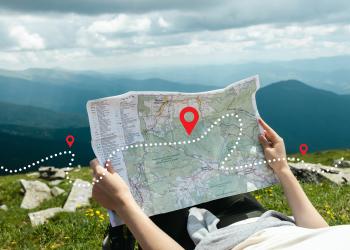
Explore our offering of brochures, maps and Recreational Opportunity Guides on subjects like recreation, sightseeing, wilderness, travel management, and vegetation.
