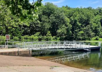
Area Status: Open
View from Sugar Camp National Forest Scenic Byway

Travel on this 28-mile drive, which combines 20 miles of paved highway and a nice 8-mile section of national forest scenic byway on maintained gravel-road. 

Most of the route is along wooded hills and valleys, which are covered with mixed hardwoods, intermingled with eastern red cedar and pine stands.  Vistas provide the opportunity to view distant landscapes.  Two areas provide spots to rest and picnic—Onyx picnic area and Sugar Camp Tower.

This pleasant, winding route is a lovely excursion, and a favorite section is the 8 mile stretch of gravel road that takes you deeper and deeper into the woods with every turn.  Look for a Sugar Camp National Forest Scenic Byway sign pointing out the turn to this portion of the byway on Highway 112, shortly after passing through Roaring River State Park.  The gravel section of the road traverses hills, valleys, and forests that turn marvel-inducing shades in the fall.

Among the varied trees are sugar maples, which settlers used to tap for their sap (maple syrup) in years gone by. 

Shortly after joining Forest Road 197, take a right at Forest Road 1004 to see Sugar Camp Fire Tower, built by the Civilian Conservation Corps (CCC) in the 1930s.  About 1.5 miles later pull of at the small Onyx Observation Area and take in the sights and sounds of nature.  The gravel road eventually returns to civilization where it meets Highway 86 near Table Rock Lake.  The remainder of the route winds through more swaths of forest before returning you to the Cassville area.

At a Glance

Reservations: All sites along the byway are first come, first served.
Area Amenities: Picnic tables, Parking
Fees: No sites along the byway charge a fee
Usage: Light
Closest Towns: Cassville; Seligman; Eagle Rock
Water: None
Restroom: None
Operated By: USDA Forest Service
Information Center: Ava Cassville/Willow Springs Ranger District
Email | Phone and Address

General Information

Directions:

From Highway 112 just south of Roaring River State Park

  • travel south approximately 2 miles,
  • turn left onto Forest Road 197 and continue until you come to Highway 86, from that point you will turn left and stay on Highway 86 until you leave the Forest Boundary just south of Bates Corner where Highways 86 and 76 meet.

Recreation Map

Map showing recreational areas. Map Information

Activities

Viewing Scenery

Onyx Observation Site

Onyx is a pull off along the side of the byway where you can park and experience singular visitas of the Ozark Highlands.

Sugar Camp Lookout Tower

This lookout tower was built by the Civilian Conservation Corp in the 1930s. This is a beautiful site to stop and have a picnic. Climbing the tower is not allowed.

OHV Road Riding

Riding on the byway, please obey county and local laws.

Picnicking

Onyx Observation Site

Onyx is a pull off along the side of the byway where you can park and experience singular visitas of the Ozark Highlands.

Sugar Camp Lookout Tower

This lookout tower was built by the Civilian Conservation Corp in the 1930s. This is a beautiful site to stop and have a picnic. Climbing the tower is not allowed.

No. of Sites
  • Onyx: 2 tables
  • Sugar Camp Lokout Tower: 1 table

Scenic Driving

The Sugar Camp Scenic Byway travels through farms, pastures, and forested landscapes.

Amenities

Parking: Onyx: 2 vehicles; Sugar Camp: 5 vehicles

Recreation Areas

Recreation Activities

Location

 
  Area/Length : 
28 miles

  Latitude : 
36.52827542

  Longitude : 
-93.82776191