Airport Loop Trails


Area Status: Open
View of West Sedona from Airport Road

Airport Loop/Table Top Trails #211/212, Bandit Trail, Brewer Trail

The trail circles the upper slope of Airport Mesa (Table Top Mountain), described clockwise here. There is no shade until reaching the last mile where it is intermittent depending on season and time of day. From the parking area, climb to the southeast about 100 yards to the top of the small saddle.

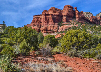
Turn right to pick up the trail which immediately bends to the left to follow the southeast slope of the mesa. There are great red rock views from northeast to south over lower Oak Creek Valley. It is a mostly level trail for the first mile and then it begins a gradual and then moderate ascent over basalt boulders to the top of the south corner of the mesa at 1.4 miles. The trail levels out, turns north and follows the airport perimeter fence for a time. It drops down to cross a small wash and climbs out to the west where it intersects the Table Top Trail at 1.7 miles.

The Table Top Trail is a half-mile (one-way) spur which climbs gradually on a finger of land extending to the southeast. It ends at at point with great panoramic views taking in the Red Rock Loop Road area to the west and many of the area's most noted formations all around. Return by the same route to the main trail and continue north. Soon, the trail begins a moderate descent and turns to the northeast. Just past the 2 mile mark, the trail intersects the top of the Bandit Trail on the left which leads down into West Sedona. As you continue ahead, the trail descends some more and levels out after a switchback. The final stretch of the trail is a gradual climb eastward.

The views here are over West Sedona and of Capitol Butte and Wilson Mountain. See a larger view of West Sedona from Airport Road. The trail ends at Airport Road across from the starting point at the parking turnout.

Hiking time: allow 2.5 hours for round trip

USGS Maps: Sedona

Notes:

No horse trailer parking.

At a Glance

Open Season: Year-round
Usage: Light-Medium
Operated By: Red Rock Ranger District 928-203-2900

General Information

Directions:

From the junction of Routes 89A and 179, take 89A west 1.0 miles to Airport Road on the left. Go 0.5 miles and park in the turnout on the left.

GPS (Map): 34°51'19.7"N 111°46'50.5"W


Click map thumbnail for larger view.

Map segment showing the Airport Trails


General Notes:

Recreation Map

Map showing recreational areas. Map Information

Activities

Mountain Biking

This West Sedona ride is a very popular hiking trail that provides a 360° view of the Sedona landscape. This ride is not for beginners or intermediate riders due to the inhospitable vegetation encroaching on the trail and the very rocky nature of the ride. Ride the loop in a counter clockwise direction even though the arrow shows the ride in a clockwise direction.

Trailhead: Park at Airport Saddle Trailhead approximately 1/2 mile up Airport Road off Hwy. 89A .

The parking lot is on the left (south) side of Airport Road and the trail starts across the road from the upper end of the parking lot. After you lift your bike over the guard rail, on the north edge of the road ride the trail in a westerly direction. At the intersection with the Sunset Trail take the Airport trail left in the uphill direction. Follow this section of trail where you will top out and be provided a great 180 degree view to the north, west and south.

After topping out you continue level for approximately 150 yards at which point the trail will pass the Table Top trail to your right. Table Top is a very rugged out and back trail that is only recommended for advanced or better riders. Continue in a southerly direction, where there are numerous cactus plants next to the edge of the trail and large round rocks that either border the trail or are in the middle of the trail. Continue on the trail until ending up back at the saddle on the east side of the mesa where you will be completing your loop.


Mountain Biking Skill Rating: Advanced

See Bicycle Restriction: Red Rock Country under Forest Orders for information about off-trail biking and permitted slickrock areas in the Sedona area.

Difficulty Level: Difficult

Day Hiking

Difficulty Level: Easy

Related Information

Recreation Areas

Recreation Activities

Location

 
  Area/Length : 
4.3 mile loop including Table Top Spur

  Latitude : 
34.85547

  Longitude : 
-111.78070

  Elevation : 
4586 - 4740