
Official websites use .gov
A .gov
website belongs to an official government organization in the
United States.
Secure .gov websites use HTTPS
A lock
(
) or https:// means you've safely
connected to the .gov website. Share sensitive information only
on official, secure websites.


Mt. Whitney Trail
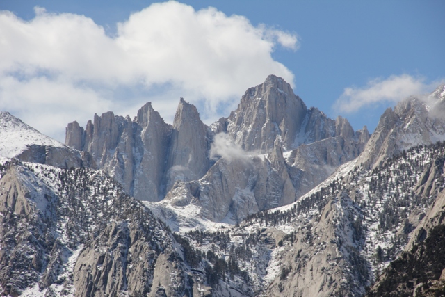
Mt. Whitney Trail climbs over 6,000 feet in 11 miles. When free of snow, it provides a strenuous, non-technical route to the summit of Mt. Whitney. Additional skills and equipment are necessary for safe travel when snow and ice are present. The trail is usually relatively snow-free from late June to mid-October.
Area Map
Mt. Whitney Trail Recreation Guide (pdf)
To purchase maps or guidebooks, visit sierraforever.org
At a Glance
| Reservations: | Reservations are made on the website: www.Recreation.gov Trips beginning May 1 through Nov 1 are reserved by lottery held in February. After the lottery any remaining space can be reserved, first come first served for the remainder of the season. Link to Mt. Whitney lottery information. |
|---|---|
| Permit Info: | Wilderness permits are required year-round for:
|
| Restrictions: |
|
| Closest Towns: | Lone Pine, CA (full service, hospital) |
| Information Center: |
|
General Information
Directions:From Highway 395 in Lone Pine, CA, travel west on Whitney Portal Road. The Mt. Whitney trailhead is located approximately 13 miles from Lone Pine on the north side of the road.
Limited parking is available at the trailhead. Please carpool.
There is a high level of bear activity at the trailhead. Remove all food and trash from vehicles and place in bear-proof lockers and trash receptacles.
Activities
Day Hiking
Backpacking


Related Links
Location
